
By Gui Oliveira
The San Francisco Recreation and Park Commission (Rec. and Park) and the San Francisco Municipal Transportation Agency Board (SFMTA) recently announced a special public hearing to discuss a “proposed pilot” on the Great Highway. The joint hearing is scheduled for Thursday, June 10 from 10 a.m. to 1 p.m. and community members are invited to share comments.
The flyer posted on social media by Rec. and Park announcing the proposed pilot on the Great Highway gives no indication what the pilot is. Instructions on the flyer for those seeking more information about the pilot are to call 311. A call to 311 resulted in reaching an operator who only had access to the flyer itself.
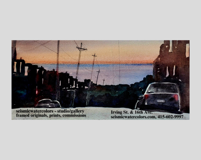
The Upper Great Highway, between Sloat Boulevard and Lincoln Way, has been closed to motor vehicles since April 2020, the early days of the coronavirus pandemic. The purpose of the closure, which was proposed by District 4 Supervisor Gordon Mar, was to create a space to allow people to safely get fresh air and exercise while staying socially distanced as recommended by health care professionals to prevent the spread of the virus.
The Upper Great Highway closure has impacted westside residents who used the road as a means to commute north and south. An estimated 17,000-19,000 commuters drove on the Upper Great Highway every day in pre-COVID times. As the pandemic restrictions are pulled back and more people are communting again, the number of cars travelling in that area is approaching the pre-pandemic range. Daily commuters have been rerouted to alternate roadways, such as Sunset Boulevard, Outer Sunset neighborhood streets and 19th Avenue, which is partially closed due to a construction project.
The SFMTA in partnership with the San Francisco County Transportation Authority (SFCTA) have implemented what it calls “a comprehensive and integrated traffic calming strategy that responds to the concerns that we have heard from residents of the Outer Sunset and Richmond districts.”
These strategies include: 24 speed cushions, one speed table, and 12 stop signs along the Lower Great Highway and outer avenues.
The SFCTA is also expected to unveil its D-4 Study evaluations in June and share its recommendations as to what the future of the Upper Great Highway will look like.
“This work involves identifying a number of street configuration options, conducting data collection and traffic analysis to evaluate the benefits and impacts of each alternative, and collecting public feedback” said Eric Young, director of communications at SFCTA.
Some of these street configuration options include five different concepts.
The concepts range from keeping the Upper Great Highway as a four-lane roadway as in pre-pandemic times to closing the Upper Great Highway to motor vehicle traffic completely and transforming it into a promenade.
Two of the more middle-of-the-road proposals is to create a shared space for vehicles and pedestrians by reducing the width of the Upper Great Highway to one vehicle lane in each direction and create a promenade in the current southbound lanes, or opening the Upper Great Highway as a promenade only on weekends, holidays, or certain seasons, thus allowing weekday commuters full northbound and southbound access.
District 1 Supervisor Connie Chan said she believes the majority of Richmond District residents fall “somewhere in between opening and closing” the Upper Great Highway. Chan said she “respects the public process” as an important aspect of having public discourse with all sides being heard in reaching “a long-term solution.”
Mar issued a statement that recognized that the Upper Great Highway as a thoroughfare for motor vehicles is on borrowed time, but he sees that reality in the future, not today.
“The vision of a waterfront promenade and a managed retreat from the coastline is the future, but we live in the present,” Mar wrote. “While I believe it’s possible to make the changes necessary to our street network to properly manage traffic flow with the Great Highway fully closed, this work would take years, and it’s unreasonable to continue a full closure beyond the emergency period without taking the long-term steps – like improving connections between the Richmond and Sunset, adding signal lights along Lincoln west of Sunset Boulevard, and redesigning the intersection at Sloat and Skyline – needed to make it successful.”
For now, Mar sees finding the middle ground as the best solution.
“I believe compromise on the post-pandemic use of the Great Highway is the right road forward, and re-opening to vehicles on weekdays or on one half of the road are both workable options,” he wrote.
Meanwhile, many members of the community remain sharply divided between those who clamor for the reopening of the roadway to cars, and those who would like the beachside open space to stay park-like permanently.
On one side of the divide, the Concerned Residents of the Sunset District, with more than 160 members, who demand Mar and others reopen the Upper Great Highway corridor to traffic.
Catherine Masterson led the Open the Great Highway protest, which took place on Lincoln Way and the Upper Great Highway on May 1.
“This is affecting the working class of San Francisco,” Masterson said. “It’s affecting people who need to commute and so, by closing this road, you’re pretty much singling out a whole population of people who need this road to live their lives.”
Retired Outer Sunset resident Patricia Arack wrote a petition calling for opening the roadway to traffic.
Arack said that the Upper Great Highway should have been completely opened to traffic seven days a week at the onset in November, 2020 of a two-year partial closure of 19th Avenue for a construction project.
“This project will result in serious congestion on that corridor and increased traffic on Sunset Boulevard and throughout all the avenues,” she said. “It makes no sense to close an alternate route to and from the peninsula during the upheaval of this construction.”
Arack said in the petition that an estimated “3,000+” cars are diverted each weekday onto the outer avenues while simultaneously allowing the highway to be “lightly used for a significant amount of time during each day.”
The City closed off several streets to vehicles and designated them as slow streets in the Sunset and Richmond districts. Slow streets are meant to give residents a safe space to get some exercise without having to deal with heavy traffic. Only local residents and vehicles taking one-block trips, like deliveries and services, are supposed to be using the slow streets.
Many people have found the closed-off Upper Great Highway to be a scenic communal space and would like to see it permanently repurposed into the Great Highway Park. People feel safe recreating on a car-free road. Kids can play on the street, ride their bikes, and draw with chalk while enjoying the beautiful open space.
Heidi Moseson is an Outer Sunset resident and a volunteer for the Great Highway Park project.
“There were a lot of us who live out here in the neighborhood who were just so thankful for the space when it happened early in the pandemic,” Moseson said. “A lot of us who live throughout the neighborhood independently came to this realization of ‘this is so amazing!’”
While dreaming of the potential for a Great Highway Park, Moseson began connecting with some other residents in the Sunset in reimagining the roadway “designed to be for people” with more benches, a fountain, more trash cans and designated bike lanes.
Her group has been in contact with Mar’s office who she says has been “very transparent and very balanced” when listening to people on both sides and in collecting the data for the D-4 Study.
However, District 4 resident Peter Pirolli, who earned a doctorate in cognitive psychology, wrote a comprehensive report to Mar questioning the integrity of the D-4 Study’s data collection.
“The D-4 Study was based on a platitude (open space is good for health) and a dollar cost estimate, rather than meaningful data, valid, prediction (e.g., model-based), and an unbiased sound evaluation of pros and cons,” according to Pirolli,
Rec. and Park spokesperson Tamara Aparton said in an email that the department is in favor of the open space.
“We are in the business of safe public spaces for recreation, so the department is inclined to see if we can make this new open space work,” Aparton wrote.
Rec. and Park is also working closely with SFMTA, SFCTA, and neighborhood stakeholders to address traffic and safety issues.
The SF Bicycle Coalition is working alongside with Mar and Chan, the SFMTA, SFCTA, and Rec. and Park to figure out solutions to traffic concerns in neighboring streets.
“A weekend-only closure would be a huge loss to the community,” said Kristen Leckie, senior community organizer at the SF Bike Coalition.
“Bringing back fast-moving traffic would impact the safety of thousands of residents and visitors who walk, bike, and play on the Great Highway every day.”

At separate demonstrations, groups rallied for and against keeping the Upper Great Highway closed to vehicular traffic. Photos by Gui Olivera.

The joint hearing on June 10 will be streamed at www.sfgovtv.org. Members of the public are encouraged to call in during the hearing or provide feedback via email. Public comment call-in number: (415) 655-0001/Access Code: 187 147 3320. Emails can be sent to SF Recreation and Park Commission: recpark.commission@sfgov.org and SFMTA Board: mtaboard@sfmta.com.
Categories: Upper Great Highway


Finally, a balanced story on the fate of the Great Highway acknowledging the very real detrimental effects closing the GH has had on people (that includes children and families by the way) that used the GH to live their lives (going to school, after school activities, work, medical and other appointments) and the abutting neighborhoods who now see much more traffic including semi-trucks, motorcycle brigades, etc cruising immediately in front of their homes in order to provide recreation in an area that already has Lake Merced, the beach, the adjacent walk way along the GH for recreation. Cars have been displaced from a highway designed for safe commuting (four lanes separated by a median to prevent head on collisions), timed traffic lights to limit speed and provide safe pedestrian crossing, no cross traffic enabling no intersection collisions which none of the streets now being used have, especially in light of the impediments to the other two north south thoroughfares (19th Avenue by construction and Sunset Blvd by slow street closures in GG Park). I am surprised that even Gordon Mar recognizes you cannot cut off a major artery without greatly hurting the interconnected networks of traffic routes and that while a “promenade” is a fine dream, it cannot be done immediately without more planning to provide traffic relief than these cumbersome and ineffective “traffic calming” measures. I am not surprised that Connie Chan is waffling again.
LikeLike
““A weekend-only closure would be a huge loss to the community,” said Kristen Leckie, senior community organizer at the SF Bike Coalition.”
Typical selfish attitude of the well-connected BC. They only think of themselves and their fancy bikes, abd the city agencies (recpark, sfmta, sfcta, mar) are toadies for them. The huge loss to the community is the horrific traffic on Sunset and 19th, and the huge loss of Safety For residents of the Sunset. Each week day the highway is at 85% EMPTY, while the poor commuter sits in congestion and gridlock in the avenues. This closure is a disgrace. It is unfair . Thousands are unsafe and miserable for the plrasure of relative few people. You have Lake Merced, GGP, lands End, many other places to walk and exercise. Also, this added human activity is destroying the vegetation in median and west of highway. That is a disgrace also.
LikeLike
You won’t need to do any traffic mitigation if you just open the dam road already. Stop throwing money at a problem that wouldn’t exist if you didn’t close the highway to being with.
LikeLike
Agreed with Parack! So is the same with the many unused bike lanes in the city. Traffic congestion causes air pollution. Needs to revert back for traffic. There are bike lanes and walk way already in place.
LikeLike
While I am glad that this article is highlighting the main issue, there are several missing items that would have added to the story – for example, the fact that the existing beach park is managed by the GGNRA, and sand is spilling over into the road, yet no cohesive recent work between the GGNRA and city appears in the public record; the fact that these entities, and several others, previously collaborated on a comprehensive long-term master plan for Ocean Beach; the fact that the D4 mobility study – which was purportedly designed to analyze usage of the area – completely omits any discussion about the existing public pathway right next to UGH (which just needs a bit of care, such as repaving and widening); the fact that the same study labels the existing highway as “high risk” with no data provided to support that conclusion; the fact that the city has not put a BUDGET in front of local residents for their review before making decisions or designing pilots; the fact that elected public servant BART commissioner Janice Li is paid a 2nd salary by the bicycle coalition for an advocacy position (documented in public records). The above items are based on established fact, not opinion. Many of us would like to see more consideration of those facts before so-called public servants issue their development and planning opinions about what is “best” for us in the outer sunset. It smells fishy like a chomped seal carcass rotting in the sand, and I can’t wait to vote . . .
LikeLike